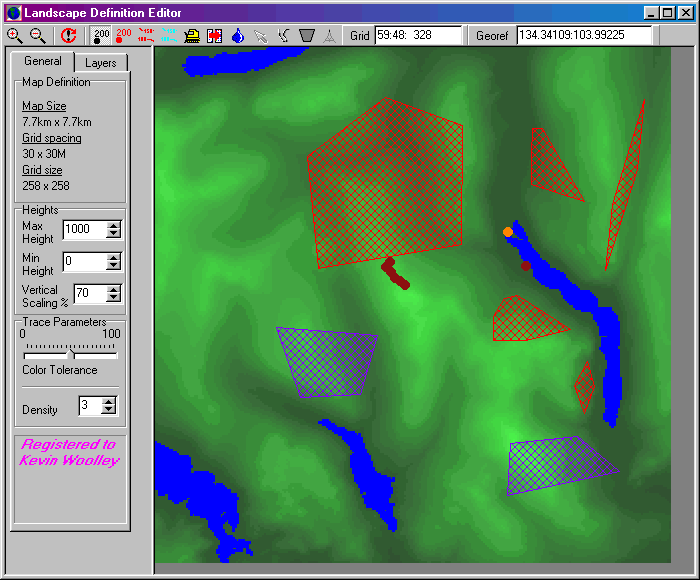
Landscape Editor
Overview
GenesisII landscapes comprise both a description of the landscape surface
and the terrains present on that landscape. The Landscape
Editor is used to define both these characteristics.
Surface shape information is held in the form of a rectangular grid. Each grid (sample) point defines the height of the surface at that point as well as certain other characteristics. The grid dimensions are arbitarily defined as meters, but in practise may be regarded as any unit.
Information about the terrains present on the surface is held as a set of terrain layers, each layer being defined as having certain characteristics. The placement of these terrains on the surface is described by a set of polygons. 3D models may also be associated with terrain layers and placed anywhere on the surface.

The Landscape Editor
The landscape editor has three main parts:
Defining the landscape surface
Before viewing a landscape with GenesisII you must define the shape
of the surface that you wish to model. GenesisII offers several ways to import
data from files. Once imported a powerful set of surface
manipulation tools can be used to edit the surface, or indeed create a surface
from scratch.
Terrains
Terrain layers are defined in the Terrains
Layers module. The terrain layers available are displayed in the check list
on the Layers page of the Parameter Display area. Terrain polygons can be defined
either using the terrain tools or by importing
GIS data.
Water
Although similar to terrains, water is defined at sample points rather
than as polygons. See the information about water tools
for details.